|
|
Advertisements:
TransportationAirports World Ranking: 62
97 (2012)
Airports - with paved runways
Total 64
Over 3,047 m 10 2,438 to 3,047 m 25 1,524 to 2,437 m 16 914 to 1,523 m 5 Under 914 m 8 (2012) Airports - with unpaved runways
Total 33
Over 3,047 m 5 2,438 to 3,047 m 7 1,524 to 2,437 m 3 914 to 1,523 m 5 Under 914 m 13 (2012) Heliports
3 (2012)
Pipelines
Condensate 658 km; gas 12,317 km; oil 11,201 km; refined products 1,095 km; water 1,465 km (2010) Railways World Ranking: 19
Total 15,079 km
Broad gauge 15,079 km 1.520-m gauge (4,000 km electrified) (2008) Roadways World Ranking: 49
Total 93,612 km
Paved 84,100 km Unpaved 9,512 km (2008) Waterways World Ranking: 26
4,000 km (on the Ertis (Irtysh) River (80%) and Syr Darya (Syrdariya) River) (2010) Merchant marine World Ranking: 109
Total 11
By type Cargo 1, petroleum tanker 8, refrigerated cargo 1, specialized tanker 1 Foreign-owned 3 (Austria 1, Ireland 1, Turkey 1) (2010) Ports and terminals
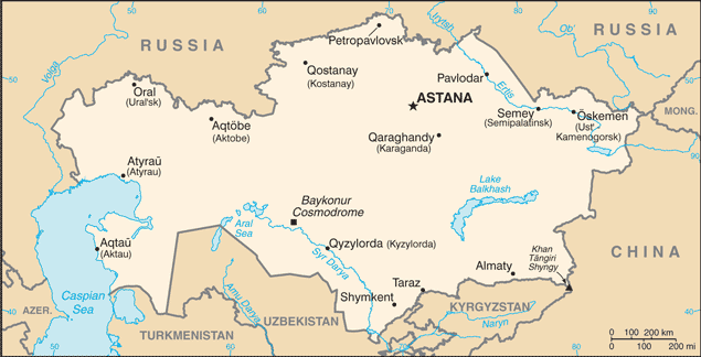
Aqtau (Shevchenko), Atyrau (Gur'yev), Oskemen (Ust-Kamenogorsk), Pavlodar, Semey (Semipalatinsk)
Comments
Add a new comment: |
Advertisement
Members area
Kazakhstan (Astana):
 
GPS points from Kazakhstan (Astana)
|
||||||||

 Ethnic Kazakhs, a mix of Turkic and Mongol nomadic tribes who migrated into the region in the 13th century, were rarely united as a single nation. The area was conquered by Russia in the 18th century, and Kazakhstan became a Soviet Republic in 1936. During the 1950s and 1960s agricultural "Virgin Lands" program, Soviet citizens were encouraged to help cultivate Kazakhstan's northern pastures. This influx of immigrants (mostly Russians, but also some other deported nationalities) skewed the ethnic mixture and enabled non-ethnic Kazakhs to outnumber natives. Independence in 1991 drove many of these newcomers to emigrate. Kazakhstan's economy is larger than those of all the other Central Asian states largely due to the country's vast natural resources. Current issues include: developing a cohesive national identity; expanding the development of the country's vast energy resources and exporting them to world markets; diversifying the economy outside the oil, gas, and mining sectors; enhancing Kazakhstan's economic competitiveness; developing a multiparty parliament and advancing political and social reform; and strengthening relations with neighboring states and other foreign powers.