41°7'24" N
44°11'32" E
~1,606m asl
10:12 (AMT - UTC/GMT+4)
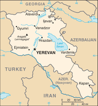
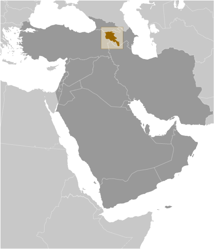
Loriyskaya Step' (Loriyskaya Step') is a upland (class T - Hypsographic) in Armenia (general), Armenia (Asia) with the region font code of Eastern Europe. It is located at an elevation of 1,606 meters above sea level.
Loriyskaya Step' is also known as Lori Plateau, Loriyskaya Step', Loriyskaya Step’, Loriyskoye Plato, Lorriyskaya Ravina, Lorrva Dasht, Lorrva Sarahart', Lorrva Sarahart’.
Its coordinates are 41°7'24" N and 44°11'32" E in DMS (Degrees Minutes Seconds) or 41.1233 and 44.1922 (in decimal degrees). Its UTM position is ML35 and its Joint Operation Graphics reference is NK38-08.
Current local time is 10:12; the sun rises at 08:53 and sets at 21:00 local time (Asia/Yerevan UTC/GMT+4). The standard time zone for Loriyskaya Step' is UTC/GMT+4
In 2024 DST starts on - and ends on -.
A Upland is an extensive interior region of high land with low to moderate surface relief.
|
Advertisements:
Advertisements:
|
Weather Loriyskaya Step' (Cloud cover, Temperature, Wind speed and Precipitation mm probab.)
Sat
Apr 27
13 °C min
14 °C max
13 km/h
Thu Jan 1
|
Sun
Apr 28
5 °C min
20 °C max
13 km/h
Thu Jan 1
|
Mon
Apr 29
7 °C min
21 °C max
11 km/h
Thu Jan 1
|
Tue
Apr 30
6 °C min
19 °C max
14 km/h
Thu Jan 1
|
Wed
May 1
6 °C min
19 °C max
12 km/h
Thu Jan 1
|
Thu
May 2
~4 l/m2 48%
7 °C min
19 °C max
10 km/h
Thu Jan 1
|
|
|
Lorrva Sarahart' (Armenia (general)) 7 day forecast
Map and Photos Loriyskaya Step'
--- There are no comments yet ---
Add a new comment:
|
Members area
Armenia (Yerevan):
Advertisement
GPS points near Loriyskaya Step'
GPS points from Armenia (Yerevan)
|
 Dashtadem (2 km)