3°10'0" S
30°19'60" E
~1,362m asl
17:33 (CAT - UTC/GMT+2)
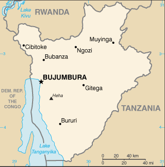
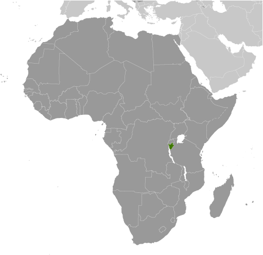
Parc national de la Ruvubu (Parc national de la Ruvubu) is a park (class L - Area) in Burundi (general), Burundi (Africa) with the region font code of Africa/Middle East. It is located at an elevation of 1,362 meters above sea level.
Its coordinates are 3°10'0" S and 30°19'60" E in DMS (Degrees Minutes Seconds) or -3.16667 and 30.3333 (in decimal degrees). Its UTM position is TB04 and its Joint Operation Graphics reference is SA36-13.
Current local time is 17:33; the sun rises at 08:53 and sets at 21:00 local time (Africa/Bujumbura UTC/GMT+2). The standard time zone for Parc national de la Ruvubu is UTC/GMT+2
In 2024 DST starts on - and ends on -.
A Park is an area, often of forested land, maintained as a place of beauty, or for recreation.
|
Advertisements:
Advertisements:
|
Weather Parc national de la Ruvubu (Cloud cover, Temperature, Wind speed and Precipitation mm probab.)
Sun
Apr 28
~8 l/m2 60%
17 °C min
23 °C max
11 km/h
Thu Jan 1
|
Mon
Apr 29
~12 l/m2 57%
15 °C min
23 °C max
8 km/h
Thu Jan 1
|
Tue
Apr 30
~14 l/m2 82%
15 °C min
25 °C max
6 km/h
Thu Jan 1
|
Wed
May 1
~29 l/m2 90%
16 °C min
23 °C max
7 km/h
Thu Jan 1
|
Thu
May 2
~19 l/m2 90%
16 °C min
23 °C max
7 km/h
Thu Jan 1
|
Fri
May 3
~34 l/m2 96%
16 °C min
22 °C max
5 km/h
Thu Jan 1
|
|
|
Parc national de la Ruvubu (Burundi (general)) 7 day forecast
Map and Photos Parc national de la Ruvubu
--- There are no comments yet ---
Add a new comment:
|
Members area
Burundi (Bujumbura):
Advertisement
GPS points near Parc national de la Ruvubu
GPS points from Burundi (Bujumbura)
 Ngiga Iprovense Ya Karuzi
|