English   Română   Español   Français   Deutsch  

getamap.net

Africa

Oceania

Asia

North America

Europe

South America

Antarctica


Rutana (724 GPS points)


Sarutoke
Sarutoke

grassland
Sesa
Sesa

grassland
Shanga
Shanga

hospital
Shanga
Shanga

school
Shanga
Shanga

populated place
Shanga
Shanga

market
Shanga
Shanga

locality
Bureau De Zone Shanga
Shanga Bureaudezone

Shasha
Shasha

locality
Shembe
Shembe

school
Shembe
Shembe

locality
Shingurwa
Shingurwa

grassland
Shoti
Shoti

populated locality
Sure
Sure

peak
Suture
Suture

populated locality
Taba
Taba

populated locality
Tahiro
Tahiro

huts
Tasi
Tasi

grassland
Terera
Terera

intermittent stream
Timbura
Timbura

cultivated area


Advertisements Advertisements


Vyuma
Vyuma

populated place
Yaba
Yaba

mountain
Yenda
Yenda

populated locality
Yove
Yove

locality
<12345678> # 724 

Comments

--- There are no comments yet ---


Add a new comment:


You have to log in to add a comment!


Advertisement


Members area


Register

Forgot password?

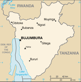
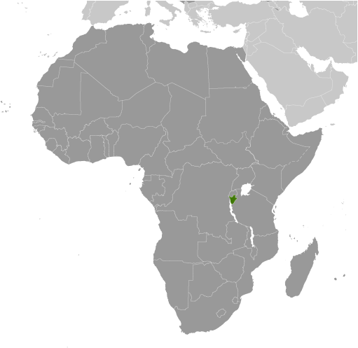
Burundi (Bujumbura):
Country Flag
Country Locator

GPS points from Burundi (Bujumbura)

square Akagoma Iprovense Ya Ngozi

square Nyabuyumpu Bubanza

square Nyamagonbe Iprovense Ya Cankuzo

square Mubwiza Iprovense Ya Cankuzo

square Gashishi Iprovense Ya Bubanza

square Gacu Cankuzo

square Rusamaza Karuzi

square Musenyi Ruyigi


viewweather.com sv.ViewWeather.com
fr.ViewWeather.com
da.ViewWeather.com
de.ViewWeather.com
es.ViewWeather.com
www.carpati.org
www.searchromania.net
Deblocari usi
es.getamap.org
fr.getamap.org
de.getamap.org
nl.getamap.org
da.getamap.org
www.getamap.org
Links
Terms of use
Privacy policy

# 0.0321 sec 

contact AT getamap.net

© 2006 - 2024  https://www.getamap.net/