49°51'7" N
6°8'5" E
~263m asl
16:55 (CEST - UTC/GMT+2)
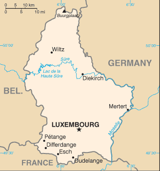
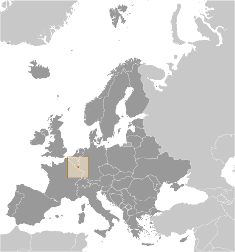
Ingeldorf (Ingeldorf) is a populated place (class P - Populated Place) in District de Diekirch (Diekirch), Luxembourg (Europe) with the region font code of Americas/Western Europe. It is located at an elevation of 263 meters above sea level and its population amounts to 833.
Ingeldorf is also known as Ingeldord, Ingeldorf.
Its coordinates are 49°51'7" N and 6°8'5" E in DMS (Degrees Minutes Seconds) or 49.8519 and 6.13472 (in decimal degrees). Its UTM position is KA92 and its Joint Operation Graphics reference is NM32-07.
Current local time is 16:55; the sun rises at 07:53 and sets at 20:00 local time (Europe/Luxembourg UTC/GMT+2). The standard time zone for Ingeldorf is UTC/GMT+1, but since Daylight Saving Time (DST) is in effect the current time zone is UTC/GMT+2.
In 2024 DST starts on 31 Mar 2024 and ends on 27 Oct 2024.
A Populated place is a city, town, village, or other agglomeration of buildings where people live and work.
|
Advertisements:
Advertisements:
|
Weather Ingeldorf (Cloud cover, Temperature, Wind speed and Precipitation mm probab.)
Sun
Apr 28
~1 l/m2 52%
9 °C min
12 °C max
33 km/h
Thu Jan 1
|
Mon
Apr 29
6 °C min
13 °C max
17 km/h
Thu Jan 1
|
Tue
Apr 30
~1 l/m2 58%
8 °C min
20 °C max
14 km/h
Thu Jan 1
|
Wed
May 1
~13 l/m2 75%
9 °C min
21 °C max
14 km/h
Thu Jan 1
|
Thu
May 2
~20 l/m2 80%
8 °C min
14 °C max
24 km/h
Thu Jan 1
|
Fri
May 3
~1 l/m2 53%
7 °C min
12 °C max
16 km/h
Thu Jan 1
|
|
|
Ingeldorf (District de Diekirch) 7 day forecast
--- There are no comments yet ---
Add a new comment:
|
Members area
Luxembourg (Luxembourg City):
Advertisement
GPS points near Ingeldorf
GPS points from Luxembourg (Luxembourg City)
 Befort District De Grevenmacher
Ell District De Diekirch
|