|
|
|
Advertisements:
GeographyLocation
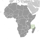
Southern Africa, group of islands at the northern mouth of the Mozambique Channel, about two-thirds of the way between northern Madagascar and northern Mozambique Geographic coordinates
12 10 S, 44 15 E
Map references
Africa
Area World Ranking: 180
Total 2,235 sq km
Land 2,235 sq km Water 0 sq km Area - comparative
Slightly more than 12 times the size of Washington, DC Land boundaries
0 km
Coastline
340 km
Maritime claims
Territorial sea 12 nm
Exclusive economic zone 200 nm Climate
Tropical marine; rainy season (November to May) Terrain
Volcanic islands, interiors vary from steep mountains to low hills Elevation extremes
Lowest point Indian Ocean 0 m
Highest point Karthala 2,360 m Natural resources
NEGL
Land use
Arable land 35.87%
Permanent crops 23.32% Other 40.81% (2005) Irrigated land
NA
Total renewable water resources
1.2 cu km (2003)
Freshwater withdrawal (domestic/industrial/agricultural)
Total 0.01 cu km/yr (48%/5%/47%)
Per capita 13 cu m/yr (1999) Natural hazards
Cyclones possible during rainy season (December to April); volcanic activity on Grand Comore Volcanism Karthala (elev. 2,361 m) on Grand Comore Island last erupted in 2007; a 2005 eruption forced thousands of people to be evacuated and produced a large ash cloud Environment - current issues
Soil degradation and erosion results from crop cultivation on slopes without proper terracing; deforestation Environment - international agreements
Party to
Biodiversity, Climate Change, Climate Change-Kyoto Protocol, Desertification, Endangered Species, Hazardous Wastes, Law of the Sea, Ozone Layer Protection, Ship Pollution, Wetlands Signed, but not ratified None of the selected agreements Geography - note
Important location at northern end of Mozambique Channel
Comments
Add a new comment: |
Advertisement
Members area
Comoros (Moroni):
 
GPS points from Comoros (Moroni)
|
||||||||

 Comoros has endured more than 20 coups or attempted coups since gaining independence from France in 1975. In 1997, the islands of Anjouan and Moheli declared independence from Comoros. In 1999, military chief Col. AZALI seized power in a bloodless coup, and helped negotiate the 2000 Fomboni Accords power-sharing agreement in which the federal presidency rotates among the three islands, and each island maintains its local government. AZALI won the 2002 presidential election, and each island in the archipelago elected its president. AZALI stepped down in 2006 and President SAMBI was elected to office. In 2007, Mohamed BACAR effected Anjouan's de-facto secession from the Union, refusing to step down in favor of fresh Anjouanais elections when Comoros' other islands held legitimate elections in July. The African Union (AU) initially attempted to resolve the political crisis by applying sanctions and a naval blockade on Anjouan, but in March 2008 AU and Comoran soldiers seized the island. The move was generally welcomed by the island's inhabitants.