|
|
|
Advertisements:
GeographyLocation
Middle East, island in the Mediterranean Sea, south of Turkey Geographic coordinates
35 00 N, 33 00 E
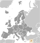
Map references
Europe
Area World Ranking: 171
Total
9,251 sq km (of which 3,355 sq km are in north Cyprus) Land 9,241 sq kmWater 10 sq km Area - comparative
About 0.6 times the size of Connecticut Land boundaries
Total 150.4 km (approximately)
Border sovereign base areas Akrotiri 47.4 km, Dhekelia 103 km (approximately) Coastline
648 km
Maritime claims
Territorial sea 12 nm
Contiguous zone 24 nm Continental shelf 200 m depth or to the depth of exploitation Climate
Temperate; Mediterranean with hot, dry summers and cool winters Terrain
Central plain with mountains to north and south; scattered but significant plains along southern coast Elevation extremes
Lowest point Mediterranean Sea 0 m
Highest point Mount Olympus 1,951 m Natural resources
Copper, pyrites, asbestos, gypsum, timber, salt, marble, clay earth pigment Land use
Arable land 10.81%
Permanent crops 4.32% Other 84.87% (2005) Irrigated land
460 sq km (2003)
Total renewable water resources
0.4 cu km (2005)
Freshwater withdrawal (domestic/industrial/agricultural)
Total 0.21 cu km/yr (27%/1%/71%)
Per capita 250 cu m/yr (2000) Natural hazards
Moderate earthquake activity; droughts Environment - current issues
Water resource problems (no natural reservoir catchments, seasonal disparity in rainfall, sea water intrusion to island's largest aquifer, increased salination in the north); water pollution from sewage and industrial wastes; coastal degradation; loss of wildlife habitats from urbanization Environment - international agreements
Party to
Air Pollution, Air Pollution-Nitrogen Oxides, Air Pollution-Persistent Organic Pollutants, Air Pollution-Sulfur 94, Biodiversity, Climate Change, Climate Change-Kyoto Protocol, Desertification, Endangered Species, Environmental Modification, Hazardous Wastes, Law of the Sea, Marine Dumping, Ozone Layer Protection, Ship Pollution, Wetlands Signed, but not ratified None of the selected agreements Geography - note
The third largest island in the Mediterranean Sea (after Sicily and Sardinia)
Comments
Add a new comment: |
Advertisement
Members area
Cyprus (Nicosia):
 
GPS points from Cyprus (Nicosia)
|
||||||||

 A former British colony, Cyprus became independent in 1960 following years of resistance to British rule. Tensions between the Greek Cypriot majority and Turkish Cypriot minority came to a head in December 1963, when violence broke out in the capital of Nicosia. Despite the deployment of UN peacekeepers in 1964, sporadic intercommunal violence continued forcing most Turkish Cypriots into enclaves throughout the island. In 1974, a Greek Government-sponsored attempt to seize control of Cyprus was met by military intervention from Turkey, which soon controlled more than a third of the island. In 1983, the Turkish Cypriot-occupied area declared itself the "Turkish Republic of Northern Cyprus" ("TRNC"), but it is recognized only by Turkey. The election of a new Cypriot president in 2008 served as the impetus for the UN to encourage both the Greek Cypriot and Turkish Cypriot communities to reopen unification negotiations. In September 2008, the leaders of the two communities began negotiations under UN auspices aimed at reuniting the divided island. The talks are ongoing and the leaders continue to meet regularly. The entire island entered the EU on 1 May 2004, although the EU acquis - the body of common rights and obligations - applies only to the areas under the internationally recognized government, and is suspended in the areas administered by Turkish Cypriots. However, individual Turkish Cypriots able to document their eligibility for Republic of Cyprus citizenship legally enjoy the same rights accorded to other citizens of European Union states.