|

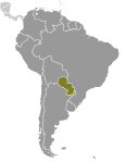
Administrative divisions (GPS Maps)
Geography
People and Society
Government
Economy
Communications
Transportation
Military |
 |
 Paraguay achieved its independence from Spain in 1811. In the disastrous War of the Triple Alliance (1865-70) - between Paraguay and Argentina, Brazil, and Uruguay - Paraguay lost two-thirds of all adult males and much of its territory. The country stagnated economically for the next half century. Following the Chaco War of 1932-35 with Bolivia, Paraguay gained a large part of the Chaco lowland region. The 35-year military dictatorship of Alfredo STROESSNER ended in 1989, and, despite a marked increase in political infighting in recent years, Paraguay has held relatively free and regular presidential elections since then. Paraguay achieved its independence from Spain in 1811. In the disastrous War of the Triple Alliance (1865-70) - between Paraguay and Argentina, Brazil, and Uruguay - Paraguay lost two-thirds of all adult males and much of its territory. The country stagnated economically for the next half century. Following the Chaco War of 1932-35 with Bolivia, Paraguay gained a large part of the Chaco lowland region. The 35-year military dictatorship of Alfredo STROESSNER ended in 1989, and, despite a marked increase in political infighting in recent years, Paraguay has held relatively free and regular presidential elections since then. |
|
Advertisements
|
Advertisements
|
Administrative divisions (4,603 GPS Maps)
--- There are no comments yet ---
Add a new comment:
|
Advertisement
Members area
Paraguay (Asuncion):
GPS points from Paraguay (Asuncion)
 Negro Departamento De Boqueron
|
