|
|
|
Advertisements:
GeographyLocation
Southeastern Asia, bordering the South China Sea and Malaysia Geographic coordinates
4 30 N, 114 40 E
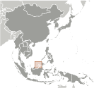
Map references
Southeast Asia
Area World Ranking: 173
Total 5,765 sq km
Land 5,265 sq km Water 500 sq km Area - comparative
Slightly smaller than Delaware
Land boundaries
Total 381 km
Border countries Malaysia 381 km Coastline
161 km
Maritime claims
Territorial sea 12 nm
Exclusive economic zone 200 nm or to median line Climate
Tropical; hot, humid, rainy
Terrain
Flat coastal plain rises to mountains in east; hilly lowland in west Elevation extremes
Lowest point South China Sea 0 m
Highest point Bukit Pagon 1,850 m Natural resources
Petroleum, natural gas, timber
Land use
Arable land 2.08%
Permanent crops 0.87% Other 97.05% (2005) Irrigated land
10 sq km (2003)
Total renewable water resources
8.5 cu km (1999)
Freshwater withdrawal (domestic/industrial/agricultural)
Total 0.09
Per capita 243 cu m/yr (1994) Natural hazards
Typhoons, earthquakes, and severe flooding are rare Environment - current issues
Seasonal smoke/haze resulting from forest fires in Indonesia Environment - international agreements
Party to
Biodiversity, Climate Change, Desertification, Endangered Species, Hazardous Wastes, Law of the Sea, Ozone Layer Protection, Ship Pollution Signed, but not ratified None of the selected agreements Geography - note
Close to vital sea lanes through South China Sea linking Indian and Pacific Oceans; two parts physically separated by Malaysia; almost an enclave within Malaysia
Comments
Add a new comment: |
Advertisement
Members area
Brunei (Bandar Seri Begawan):
 
GPS points from Brunei (Bandar Seri Begawan)
|
||||||||

 The Sultanate of Brunei's influence peaked between the 15th and 17th centuries when its control extended over coastal areas of northwest Borneo and the southern Philippines. Brunei subsequently entered a period of decline brought on by internal strife over royal succession, colonial expansion of European powers, and piracy. In 1888, Brunei became a British protectorate; independence was achieved in 1984. The same family has ruled Brunei for over six centuries. Brunei benefits from extensive petroleum and natural gas fields, the source of one of the highest per capita GDPs in Asia.