|
|
|
Advertisements:
GeographyLocation
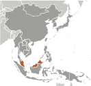
Southeastern Asia, peninsula bordering Thailand and northern one-third of the island of Borneo, bordering Indonesia, Brunei, and the South China Sea, south of Vietnam Geographic coordinates
2 30 N, 112 30 E
Map references
Southeast Asia
Area World Ranking: 67
Total 329,847 sq km
Land 328,657 sq km Water 1,190 sq km Area - comparative
Slightly larger than New Mexico Land boundaries
Total 2,669 km
Border countries Brunei 381 km, Indonesia 1,782 km, Thailand 506 km Coastline
4,675 km (Peninsular Malaysia 2,068 km, East Malaysia 2,607 km) Maritime claims
Territorial sea 12 nm
Exclusive economic zone 200 nm Continental shelf 200 m depth or to the depth of exploitation; specified boundary in the South China Sea Climate
Tropical; annual southwest (April to October) and northeast (October to February) monsoons Terrain
Coastal plains rising to hills and mountains Elevation extremes
Lowest point Indian Ocean 0 m
Highest point Gunung Kinabalu 4,100 m Natural resources
Tin, petroleum, timber, copper, iron ore, natural gas, bauxite Land use
Arable land 5.46%
Permanent crops 17.54% Other 77% (2005) Irrigated land
3,650 sq km (2003)
Total renewable water resources
580 cu km (1999)
Freshwater withdrawal (domestic/industrial/agricultural)
Total 9.02 cu km/yr (17%/21%/62%)
Per capita 356 cu m/yr (2000) Natural hazards
Flooding; landslides; forest fires Environment - current issues
Air pollution from industrial and vehicular emissions; water pollution from raw sewage; deforestation; smoke/haze from Indonesian forest fires Environment - international agreements
Party to
Biodiversity, Climate Change, Climate Change-Kyoto Protocol, Desertification, Endangered Species, Hazardous Wastes, Law of the Sea, Marine Life Conservation, Ozone Layer Protection, Ship Pollution, Tropical Timber 83, Tropical Timber 94, Wetlands Signed, but not ratified None of the selected agreements Geography - note
Strategic location along Strait of Malacca and southern South China Sea
Comments
Add a new comment: |
Advertisement
Members area
Malaysia (Kuala Lumpur):
 
GPS points from Malaysia (Kuala Lumpur)
|
||||||||

 During the late 18th and 19th centuries, Great Britain established colonies and protectorates in the area of current Malaysia; these were occupied by Japan from 1942 to 1945. In 1948, the British-ruled territories on the Malay Peninsula except Singapore formed the Federation of Malaya, which became independent in 1957. Malaysia was formed in 1963 when the former British colonies of Singapore as well as Sabah and Sarawak on the northern coast of Borneo joined the Federation. The first several years of the country's independence were marred by a Communist insurgency, Indonesian confrontation with Malaysia, Philippine claims to Sabah, and Singapore's departure from the Federation in 1965. During the 22-year term of Prime Minister MAHATHIR bin Mohamad (1981-2003), Malaysia was successful in diversifying its economy from dependence on exports of raw materials to the development of manufacturing, services, and tourism. Prime Minister Mohamed NAJIB bin Abdul Razak (in office since April 2009) has continued these pro-business policies.