|
|
|
Advertisements:
TransportationAirports World Ranking: 32
191 (2012)
Airports - with paved runways
Total 58
Over 3,047 m 5 2,438 to 3,047 m 21 1,524 to 2,437 m 16 914 to 1,523 m 12 Under 914 m 4 (2012) Airports - with unpaved runways
Total 133
2,438 to 3,047 m 1 1,524 to 2,437 m 19 914 to 1,523 m 30 Under 914 m 83 (2012) Heliports
4 (2012)
Pipelines
Extra heavy crude 533 km; gas 1,526 km; liquid petroleum gas 679 km; oil 1,033 km; refined products 15 km (2010) Railways World Ranking: 74
Total 1,906 km
Standard gauge 1,772 km 1.435-m gauge Narrow gauge 134 km 0.914-m gauge (2010) Roadways World Ranking: 35
Total 137,327 km
Note Includes 26,017 km of national roads, 28,843 km of departmental roads, and 82,467 km of local roads (2007) Waterways World Ranking: 14
8,808 km (there are 8,600 km of navigable tributaries on the Amazon system and 208 km on Lago Titicaca) (2011) Merchant marine World Ranking: 92
Total 22
By type Cargo 2, chemical tanker 5, liquefied gas 2, petroleum tanker 13 Foreign-owned 8 (Chile 6, Ecuador 1, Spain 1) Registered in other countries 9 (Panama 9) (2010)Ports and terminals
Callao, Iquitos, Matarani, Paita, Pucallpa, Yurimaguas; note - Iquitos, Pucallpa, and Yurimaguas are on the upper reaches of the Amazon and its tributaries Oil terminals Conchan oil terminal, La Pampilla oil terminal
Comments
Add a new comment: |
Advertisement
Members area
Peru (Lima):
 
GPS points from Peru (Lima)
|
||||||||

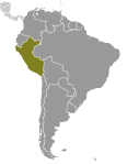 Ancient Peru was the seat of several prominent Andean civilizations, most notably that of the Incas whose empire was captured by the Spanish conquistadors in 1533. Peruvian independence was declared in 1821, and remaining Spanish forces were defeated in 1824. After a dozen years of military rule, Peru returned to democratic leadership in 1980, but experienced economic problems and the growth of a violent insurgency. President Alberto FUJIMORI's election in 1990 ushered in a decade that saw a dramatic turnaround in the economy and significant progress in curtailing guerrilla activity. Nevertheless, the president's increasing reliance on authoritarian measures and an economic slump in the late 1990s generated mounting dissatisfaction with his regime, which led to his ouster in 2000. A caretaker government oversaw new elections in the spring of 2001, which ushered in Alejandro TOLEDO Manrique as the new head of government - Peru's first democratically elected president of Native American ethnicity. The presidential election of 2006 saw the return of Alan GARCIA Perez who, after a disappointing presidential term from 1985 to 1990, has overseen a robust macroeconomic performance. In June 2011, former army officer Ollanta HUMALA Tasso was elected president, defeating Keiko FUJIMORI Higuchi, the daughter of Alberto FUJIMORI. Since his election, HUMALA has carried on the sound, market-oriented economic policies of the three preceeding administrations.