|
|
|
Advertisements:
TransportationAirports World Ranking: 176
6 (2012)
Airports - with paved runways
Total 1
2,438 to 3,047 m 1 (2012) Airports - with unpaved runways
Total 5
1,524 to 2,437 m 1 914 to 1,523 m 3 Under 914 m 1 (2012) Roadways World Ranking: 188
Total 680 km
Paved 184 km Unpaved 496 km (2000) Merchant marine World Ranking: 122
Total 7
By type Cargo 4, carrier 1, passenger/cargo 2 Foreign-owned 2 (Australia 1, UK 1) (2010)Ports and terminals
Nuku'alofa, Neiafu, Pangai
Comments
Add a new comment: |
Advertisement
Members area
Tonga (Nuku'alofa):
 
GPS points from Tonga (Nuku'alofa)
|
||||||||

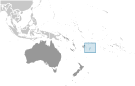 Tonga - unique among Pacific nations - never completely lost its indigenous governance. The archipelagos of "The Friendly Islands" were united into a Polynesian kingdom in 1845. Tonga became a constitutional monarchy in 1875 and a British protectorate in 1900; it withdrew from the protectorate and joined the Commonwealth of Nations in 1970. Tonga remains the only monarchy in the Pacific.