|
|
|
Weather Al Bahath (Cloud cover, Temperature, Wind speed and Precipitation mm probab.)
Map and Photos Al Bahath
Comments
Add a new comment: |
Members area
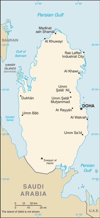
Qatar (Doha):
Advertisement
GPS points near Al Bahath
 Al Usailah (1 km)
Al `Usaylah (1 km)
Barthat al Khursa`ah (1 km)
Al Afjah (2 km)
Umm al Adham (3 km)
Umm al Adhem (3 km)
Al Tawiyeh (3 km)
At Tawil (3 km)
At Tawiyah (3 km)
At Tuwayyil (3 km)
Hazm at Tawil (3 km)
Hajm Twail (3 km)
Hazm Twail (3 km)
Al Khursa`ah (4 km)
Khursa`at al Bahat (4 km)
Waqbat al Barraq (4 km)
Al Bahath (4 km)
Al Usailah (1 km)
Al `Usaylah (1 km)
Barthat al Khursa`ah (1 km)
Al Afjah (2 km)
Umm al Adham (3 km)
Umm al Adhem (3 km)
Al Tawiyeh (3 km)
At Tawil (3 km)
At Tawiyah (3 km)
At Tuwayyil (3 km)
Hazm at Tawil (3 km)
Hajm Twail (3 km)
Hazm Twail (3 km)
Al Khursa`ah (4 km)
Khursa`at al Bahat (4 km)
Waqbat al Barraq (4 km)
Al Bahath (4 km)
GPS points from Qatar (Doha)
|