24°51'37" N
51°29'40" E
~2m asl
04:10 (AST - UTC/GMT+3)
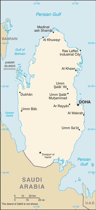
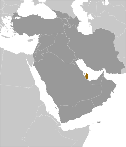
Naga Abu Anfus (Naga Abu Anfus) is a dune(s) (class T - Hypsographic) in Baladiyat al Wakrah (Qatar (general)), Qatar (Asia) with the region font code of Africa/Middle East. It is located at an elevation of 2 meters above sea level.
Naga Abu Anfus is also known as Abu `Anfuz, Abū ‘Anfūz, Naga Abu Anfus, Naqa Abu `Anfus, Naqa Abu `Anfuz, Naqā Abū ‘Anfūz, Naqā Abū ‘Anfūş, نَقَا أَبُو عَنْفُوص.
Its coordinates are 24°51'37" N and 51°29'40" E in DMS (Degrees Minutes Seconds) or 24.8603 and 51.4944 (in decimal degrees). Its UTM position is WH44 and its Joint Operation Graphics reference is NG39-15.
Current local time is 04:10; the sun rises at 08:54 and sets at 21:01 local time (Asia/Qatar UTC/GMT+3). The standard time zone for Naga Abu Anfus is UTC/GMT+3
In 2024 DST starts on - and ends on -.
A Dune(s) is a wave form, ridge or star shape feature composed of sand.
|
Advertisements:
Advertisements:
|
Weather Naga Abu Anfus (Cloud cover, Temperature, Wind speed and Precipitation mm probab.)
Fri
Apr 26
28 °C min
29 °C max
19 km/h
Thu Jan 1
|
Sat
Apr 27
25 °C min
33 °C max
17 km/h
Thu Jan 1
|
Sun
Apr 28
26 °C min
33 °C max
24 km/h
Thu Jan 1
|
Mon
Apr 29
26 °C min
32 °C max
24 km/h
Thu Jan 1
|
Tue
Apr 30
26 °C min
33 °C max
25 km/h
Thu Jan 1
|
Wed
May 1
26 °C min
33 °C max
45 km/h
Thu Jan 1
|
|
|
Naqa Abu `Anfus (Baladiyat al Wakrah) 7 day forecast
Map and Photos Naga Abu Anfus
--- There are no comments yet ---
Add a new comment:
|
Members area
Qatar (Doha):
Advertisement
GPS points near Naga Abu Anfus
GPS points from Qatar (Doha)
|
 Mamlahah (1 km)